- November 13, 2024
Quick Sneak-Peek
| Range | Himalaya |
| Duration | —— days |
| Distance | 37 km |
| Altitude | Max: 5,400 m |
| Season | June- October |
| Zone and Permit | Open, no permit |
| Public Transport | Yes |
| Summary | A quick, easy approach through lovely meadows leads to the enormous Nanga Parbat base camp Rupal face. |
Do you know that Nanga Parbat is the second highest peak in Pakistan and the 9th highest peak in the world? It stands as an isolated and unique mass of snow and ice as the westernmost pillar of the Himalayan mountain range, around which the Indus river skirts into the plains of Pakistan. Isn’t that amazing to know?
Where its located?
It is located in the Astore Gilgit-Baltistan region of Pakistan and also located where the continents have collided. It is where the Indian plate is going under the Asian plate at a rate of about a few inches.
Insights of Rupal face base camp
- Nanga Parbat is not a single peak but consists of 20 km. long series of ridges culminating in an ice crest of 8,126 meters. It has three faces known as, Raikot Face, Diamer, and South face.
- Its South Face also known as Rupal Face, is said to be the highest mountain wall from base to summit with a sheer 4,500 m. cliff.
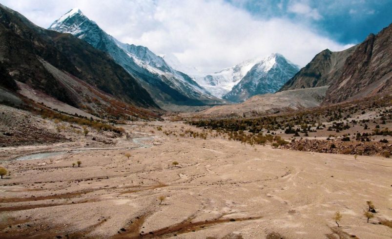
- This long Nanga Parbat trek of 5-6 hours walk is tiring but takes us through lush green potato fields of Rupal valley (Astore) to the base camp. And what a view awaits us then!!! i.e., A massive peak of Nanga Parbat from a close distance.
- What more you can explore?
On this route, there could be two options, whether to return from there or carry on to Mazino Pass- 5,400 m., the highest point of this trek, which is the most challenging part of this trek but offers truly breathtaking sights of this Himalayan giant.
- What about Guides and Porters?
It’s essential and safe to take services from a reputable, licensed guide who is accustomed to dealing with Rupal Base Camp Astore porters and villagers. Porters come from Tarashing and Chorit points, which have decided that an equal number of porters for any party are to be from each village. Normally, porters, who transport loads on donkeys, ask for a flat rate per stage, including payment for food rations, and expect large parties to buy a goat at Shaigiri.
From where to start?
Here we go!!! [down arrows]
The six stages total round trip from Tarashing:
(1) Herrligkoffer Base Camp;
(2) Latobah;
(3) Shaigiri; and
(4-6) three stages to return via the same route.
Starting from Nearest Village Tarashing
There are various Tourist Cottages at Nanga Parbat having luscious gardens and everything you need. Remember, Hotels at Nanga Parbat have a higher camping fee and room’s cost.
The narrow jeep road to Astor leaves at Jaglot, 60Km south of Gilgit and 30Km north of Raikot Bridge, crossing a bridge over the Indus River and heading 40Km southeast up the Astor Valley skirting Nanga Parbat’s northeast flank. Gilgit- Astor jeeps (three to four hours) go all day from Gilgit- Jaglot bus stand on Domyal Link Rd. Gilgit- Astor special hires one way. Astor- Tarashing jeeps take two hours and special hires take 15 minutes less.
Getting To/ From the Trek
The Trek
- Day 1: Tarashing to Herrligkoffer Base camp
- 5 hours, 10km, 639m ascent
- 5 hours, 10km, 639m ascent
- From Tarashing (2911m), climb the Tarashing Glacier’s lateral moraine, near the village’s north edge, and cross the glacier on a trail. Continue up the gentle valley through Rupal village. Rising gradually through Rupal’s lush fields, the trail follows the valley’s north side to Herrligkoffer Base Camp (3550m), a beautiful, although much- used, meadow along the Bazhin Glacier’s east margin.
- A side trip of several hours up this ablation valley leads to a point on the moraine directly above the Bazhin Glacier and across from the icefall coming from the summit.
- Day 2: Herrligkoffer Base Camp to Latobah
- 2 hours, 3km, 20m descent
- 2 hours, 3km, 20m descent
- Cross the Bazhin Glacier Over a trail in 1½ hours to reach Latobah (3530m), the broad, level meadows frequented by Rupal herders. Latobah is also known as Tupp Meadows.
- Day 3: Latobah to Shaigiri
- 4 hours, 5.5Km, 125m ascent
- 4 hours, 5.5Km, 125m ascent
- The trail stays to the north of the Rupal Gah, Skirting the terminal moraine and a silty moraine lake. Continue through a series of alluvial fans and skirt the Shaigiri Glacier’s terminal moraine. Just beyond is Shaigiri (3655m), a summer settlement marked by an erratic, a white boulder (Shaigiri in Shina), and more awesome views of the south face.
- Days 4-5: Shaigiri to Tarashing
- 2 days, 18.5km, 744m descent
- 2 days, 18.5km, 744m descent
- Retrace steps to Tarashing, camping at Rupal Base Camp Astore on Day 4.
So, now you know Rupal Base Camp is an answer to all your camping and trekking dreams, Then what’s stopping you from going there.


