- November 12, 2024
Introduction
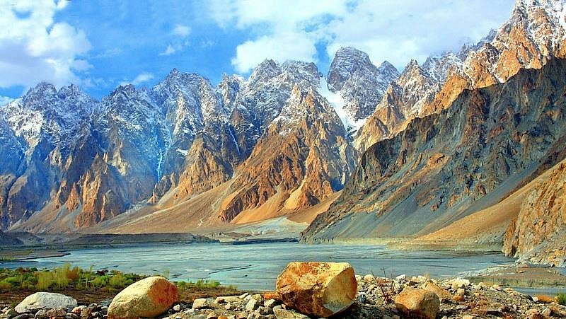
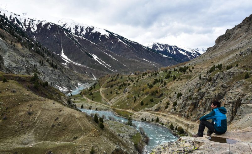
Astore Valley, nestled in Gilgit-Baltistan, Pakistan, is a hidden paradise boasting breathtaking meadows, lakes, and mountains. It serves as the gateway to Deosai National Park and offers a spectacular blend of natural beauty, adventure, and culture. The valley is home to Rama Meadows, Minimarg, Rupal Valley, and Domel, making it a perfect travel destination for explorers, hikers, and nature lovers.
History
The Astore Valley has been historically significant due to its strategic location. It was an important trade route connecting Kashmir and Gilgit. The valley has witnessed various rulers, including Dogras and British forces, before becoming a part of Pakistan. The region has a rich cultural and historical heritage, making it a fascinating destination for history buffs.
Cultural Heritage
The people of Astore Valley belong to diverse ethnic backgrounds, primarily Shina-speaking communities. The locals are known for their hospitality, traditional music, and handmade crafts. Festivals like Jashn-e-Baharan and Harvest Festivals showcase their vibrant culture. Traditional houses made of wood and stone highlight the rich architectural heritage of the valley.
Best Time to Visit
- Summer (May to September) – Best time for trekking, camping, and sightseeing. The weather is pleasant with lush green landscapes.
- Winter (November to February) – Ideal for snow lovers. The valley receives heavy snowfall, making it perfect for winter photography and snow adventures.
- Spring (March to April) – The valley blooms with colorful flowers, offering a picturesque experience.
How to Reach from Islamabad
- By Car/Bike: Take the Karakoram Highway (KKH) towards Gilgit. From Gilgit, follow the Astore Road (approx. 110 km).
- By Bus: Daily bus services are available from Islamabad to Gilgit, from where you can hire a jeep or take a local van to Astore Valley.
- By Air: Flights from Islamabad to Skardu, then a road journey to Astore (approx. 4-5 hours).
Places to Visit in Astore Valley
Rama Meadows
Rama Meadows is a breathtaking alpine meadow surrounded by snow-capped mountains and lush green landscapes. It offers a perfect retreat for nature lovers and photographers.
- Location: Near Astore Town in Gilgit-Baltistan.
- How to Reach: Ride via Astore Road, approx. 10 km from the main town.
- Places to Visit: Rama Lake, Rama Mosque, Pine Forests.
- Key Attractions: Lush green meadows, snowy peaks, Rama Lake.
- Best Time to Visit: May to September.
- Activities to Do: Camping, photography, trekking.
Minimarg
Minimarg is an enchanting valley known for its vibrant landscapes, colorful meadows, and serene lakes. It is a dream destination for those who seek untouched natural beauty.
- Location: Near Line of Control (LoC), Gilgit-Baltistan.
- How to Reach: Requires NOC (No Objection Certificate) for non-locals. Accessible via Chillam Checkpost.
- Places to Visit: Rainbow Lake, Domel Meadows, Army Checkpost.
- Key Attractions: Crystal-clear lakes, colorful meadows.
- Best Time to Visit: June to September.
- Activities to Do: Nature walks, sightseeing, off-road adventures.
Deosai Plains
Deosai Plains, also known as the Land of Giants, is the second-highest plateau in the world. It is home to diverse wildlife, breathtaking landscapes, and serene lakes.
- Location: Between Astore Valley and Skardu.
- How to Reach: Take the road via Chillam Valley.
- Places to Visit: Sheosar Lake, Bara Pani, Kala Pani.
- Key Attractions: Second highest plateau in the world, wildlife sightings.
- Best Time to Visit: June to August.
- Activities to Do: Wildlife photography, camping, jeep safari.
Rupal Valley
Rupal Valley is a hidden gem offering breathtaking views of Nanga Parbat, the killer mountain. It is a paradise for trekkers and adventure seekers.
- Location: South face of Nanga Parbat, near Tarishing.
- How to Reach: Drive from Astore to Tarishing, then trek to Rupal Valley.
- Places to Visit: Nanga Parbat Base Camp, Herrligkoffer Base Camp.
- Key Attractions: Stunning views of Nanga Parbat, lush green landscapes.
- Best Time to Visit: July to September.
- Activities to Do: Trekking, mountaineering, photography.
Domel
Domel is a mesmerizing valley known for its lush green landscapes, pristine rivers, and scenic hiking trails. It offers an escape into untouched nature, making it an ideal spot for camping and trekking.
- Location: Near Minimarg, Astore Valley, Gilgit-Baltistan.
- How to Reach: Requires NOC for non-locals. Accessible via Minimarg road.
- Places to Visit: Domel Meadows, Rainbow Lake, Army Checkpost.
- Key Attractions: Vibrant meadows, crystal-clear lakes, serene environment.
- Best Time to Visit: June to September.
- Activities to Do: Trekking, sightseeing, photography, camping.
Chillam Valley
Chillam Valley is the gateway to Deosai National Park and offers some of the most breathtaking high-altitude landscapes. It is a must-visit for adventurers heading towards Deosai.
- Location: Along the Astore-Deosai route, Gilgit-Baltistan.
- How to Reach: Travel via Astore-Chillam Road (approx. 40 km from Astore town).
- Places to Visit: Chillam Checkpost, Deosai Plains, Sheosar Lake.
- Key Attractions: Snow-covered peaks, lush pastures, wildlife sightings.
- Best Time to Visit: June to August.
- Activities to Do: Camping, off-road biking, wildlife exploration.
Gudai
Gudai is a hidden valley in Astore that remains relatively unexplored. It is home to dense pine forests, glacial streams, and charming village settlements.
- Location: Near Astore Town, Gilgit-Baltistan.
- How to Reach: Travel via Astore Road, approximately 15 km from Astore town.
- Places to Visit: Gudai Forests, Waterfalls, Local Villages.
- Key Attractions: Lush green scenery, cool climate, rich biodiversity.
- Best Time to Visit: May to October.
- Activities to Do: Nature walks, forest exploration, birdwatching.
Kamri Valley
Kamri Valley is an untouched paradise with rolling green hills, alpine meadows, and cold mountain streams. It is a dreamland for adventure seekers and peace lovers.
- Location: Near Astore, bordering Azad Kashmir.
- How to Reach: Requires 4×4 vehicles, accessible via Astore-Gudai-Kamri route.
- Places to Visit: Kamri Meadows, Kamri Fort, Local Settlements.
- Key Attractions: Scenic landscapes, cultural heritage, peaceful ambiance.
- Best Time to Visit: June to September.
- Activities to Do: Trekking, sightseeing, cultural exploration.
Tarishing
Tarishing serves as the base camp for Rupal Valley and Nanga Parbat expeditions. It is a small yet beautiful village surrounded by towering peaks.
- Location: At the foot of Nanga Parbat, Astore Valley, Gilgit-Baltistan.
- How to Reach: Travel via Astore-Rupal Road, approximately 30 km from Astore town.
- Places to Visit: Rupal Valley, Herrligkoffer Base Camp, Tarishing Meadows.
- Key Attractions: Panoramic views of Nanga Parbat, traditional village lifestyle.
- Best Time to Visit: June to September.
- Activities to Do: Trekking, mountaineering, village walks.
Suggested 6 Days Itinerary from Islamabad
Islamabad to Astore Valley – Day 1
- Depart from Islamabad early in the morning to begin the journey.
- Travel via Murree, Abbottabad, and Mansehra.
- Lunch break at Besham or Chilas for refreshments.
- Continue the journey towards Astore Valley, driving through the scenic Chilas and Jaglot areas.
- Arrive at Astore by evening.
- Overnight stay at a guesthouse in Astore.
Rama Meadows and Rama Lake – Day 2
- Morning: Depart for Rama Meadows from Astore after breakfast.
- Enjoy a scenic drive through lush forests and picturesque villages.
- Arrive at Rama Meadows, surrounded by snow-capped peaks and lush meadows.
- Explore the area, trek around, and enjoy wildlife sightings.
- Lunch by Rama Lake, a serene location with beautiful surroundings.
- Afternoon: Spend time exploring the Rama Lake and surrounding areas.
- Evening: Return to Astore town for rest and dinner.
- Overnight stay in Astore.
Rupal Valley and Tarishing – Day 3
- Morning: Depart for Rupal Valley after an early breakfast.
- Arrive at Rupal Valley, enjoy panoramic views of Nanga Parbat.
- Visit the Rupal Base Camp and trek to experience the area’s rugged beauty.
- Continue to Tarishing, a beautiful village known for its mountaineering expeditions.
- Lunch in Tarishing, enjoy the local hospitality.
- Afternoon: Explore the village and interact with locals.
- Evening: Return to Astore for the night.
- Overnight stay in Astore.
Deosai Plains and Chillam Valley – Day 4
- Morning: Early departure for Chillam Valley, gateway to Deosai National Park.
- Arrive in Chillam Valley, famous for its high-altitude beauty and wildlife.
- Drive to Deosai Plains and take in the vast landscapes and rolling meadows.
- Visit Sheosar Lake, a stunning high-altitude lake surrounded by nature.
- Lunch amidst the beauty of Deosai’s landscape.
- Afternoon: Enjoy wildlife photography or take a short trek around the area.
- Evening: Return to Astore for rest and overnight stay.
- Overnight stay in Astore.
Domel, Gudai, and Kamri Valley – Day 5
- Morning: Head towards Domel from Astore after breakfast.
- Explore Domel, a beautiful area known for its picturesque meadows.
- Continue to Gudai, a hidden valley surrounded by thick forests and mountains.
- Lunch at a local guesthouse in Gudai.
- Afternoon: Head towards Kamri Valley, known for its scenic landscapes and rolling hills.
- Explore the area and enjoy the views.
- Evening: Return to Astore town for the final overnight stay.
- Overnight stay in Astore.
Return to Islamabad – Day 6
- Depart early from Astore Valley.
- Stop for lunch in Chilas or Besham.
- Arrive in Islamabad by evening.
Where to Stay in Astore Valley:
When traveling to Astore Valley, accommodation options can range from basic guesthouses to more comfortable hotels. Here are some recommended places to stay:
- Astore Guesthouse: A budget-friendly option with basic amenities. It’s located in the heart of Astore and offers a peaceful environment with beautiful views of the valley.
- Rama Resort: For a more comfortable stay, the Rama Resort offers modern facilities while maintaining a traditional atmosphere. It’s situated near Rama Meadows, providing easy access to scenic spots.
- Nanga Parbat View Hotel: This hotel provides stunning views of Nanga Parbat. It’s located near the town and offers a mix of traditional and modern services.
- Deosai National Park Campsites: If you prefer an adventurous stay, there are campsites in Deosai National Park for a unique experience surrounded by nature.
Emergency Contacts & Health Precautions:
- Emergency Numbers:
- Police: 15
- Rescue Services (Ambulance): 1122
- Fire Services: 16
- Local Hospitals:
- Astore Hospital: +92 5812 92034
- Chilas Hospital (for emergencies): +92 5747 22544
- Health Precautions:
- Altitude Sickness: Astore Valley is at a high altitude, so it’s important to acclimatize before trekking in areas like Rama Meadows or Rupal Valley. Drink plenty of water, avoid heavy exertion during the first day, and keep yourself hydrated.
- Mosquito Protection: Mosquitoes can be common in the warmer months, especially around Rama Lake and Deosai Plains. Use insect repellent and wear long-sleeve clothing to avoid bites.
- Food & Water Safety: Always drink bottled or purified water. Avoid consuming raw food or unpeeled fruits from local markets to prevent foodborne illnesses.
- First Aid Kit: Carry a personal first-aid kit with basic medications like pain relievers, bandages, antiseptics, and any prescription medicines you might need.
Travel Tips
- Pack Light, but Smart: Since you’ll be trekking through varied terrains, it’s important to pack light but ensure you have everything necessary. Include a good pair of trekking shoes, warm clothes (it can get chilly in the evenings), and a waterproof jacket.
- Respect Local Customs: The people of Astore Valley are known for their hospitality, but it’s important to respect their culture. Dress modestly, especially when visiting villages and interacting with locals.
- Photography: Astore Valley offers amazing scenic views and cultural landmarks. While photographing people, always ask for permission first to respect their privacy and traditions.
- Fuel & Supplies: Be aware that fuel stations and stores are limited in Astore Valley. Ensure you carry sufficient fuel and essential supplies like snacks, water, and toiletries.
- Local Currency: Always carry sufficient cash, as ATMs are scarce in remote areas. The local currency is the Pakistani Rupee (PKR), and credit cards may not be widely accepted in more rural locations.
FAQs
What is the best time to visit Astore Valley?
The best time to visit Astore Valley is between May and September. During these months, the weather is generally pleasant, and the roads are accessible, making it perfect for trekking and exploring. However, if you wish to experience snow-covered landscapes, visiting during the winter months, particularly December to February, can offer a unique and serene experience.
How can I reach Astore Valley from Islamabad?
To reach Astore Valley from Islamabad, you will travel via the Karakoram Highway. The journey typically takes 13-15 hours, depending on road conditions and stops along the way. You can either drive your own vehicle or hire a private jeep. The route is scenic, passing through Chilas, Jaglot, and Mansehra, providing breathtaking views of the mountains.
What are the top places to visit in Astore Valley?
Astore Valley is home to numerous stunning attractions. Some of the must-visit spots include Rama Meadows, known for its lush greenery and alpine meadows; Rama Lake, a serene and picturesque destination; Rupal Valley, offering spectacular views of Nanga Parbat; and Deosai National Park, a high-altitude plateau with diverse wildlife. These spots, along with Chillam Valley and Kamri Valley, provide an unforgettable experience for nature lovers.
Is Astore Valley safe for tourists?
Yes, Astore Valley is generally safe for tourists, especially when you follow the basic travel precautions. While the valley is remote, it is a popular destination for nature enthusiasts. It’s always recommended to travel with a guide if you are unfamiliar with the region, and to carry essential supplies since amenities may be limited in the more remote areas.
What activities can I do in Astore Valley?
Astore Valley offers a range of outdoor activities for adventure seekers. You can enjoy trekking, camping, and wildlife photography in areas like Rama Meadows and Deosai National Park. Visitors also enjoy exploring the historical sites in Rupal Valley and Rama Lake, as well as indulging in local cultural experiences by interacting with the indigenous communities.
Are there any hotels or guesthouses in Astore Valley?
Yes, there are various accommodation options in Astore Valley, ranging from budget guesthouses to more comfortable hotels. Some popular places to stay include the Rama Resort, which is known for its scenic views and modern amenities, and Nanga Parbat View Hotel, offering breathtaking views of the surrounding mountains. It’s advisable to book in advance during peak tourist seasons.
What is the weather like in Astore Valley?
Astore Valley experiences cool, pleasant weather during the summer, with temperatures ranging from 10°C to 25°C. Winters are much colder, with temperatures often dropping below freezing, especially in high-altitude areas such as Rama Meadows and Deosai National Park. Therefore, it’s essential to pack accordingly, depending on the season of your visit.
Is there mobile network coverage in Astore Valley?
While mobile network coverage is available in Astore town, it can be limited in more remote areas like Rama Meadows and Rupal Valley. It’s recommended to inform family or friends about your travel plans and consider downloading offline maps and important travel details before heading to these areas.
By answering these common questions, we hope you are now better prepared to explore the natural beauty and hidden gems of Astore Valley.
Conclusion
Astore Valley is an undiscovered gem, nestled in the northern regions of Pakistan, offering a blend of pristine nature, cultural heritage, and adventure. Whether you are looking to trek through Rama Meadows, witness the Nanga Parbat from Rupal Valley, or enjoy the tranquility of Deosai National Park, Astore Valley has something for every kind of traveler. By following proper health precautions, respecting local customs, and planning ahead, your trip to this breathtaking valley will be an unforgettable experience. So pack your bags, and get ready to explore one of Pakistan’s most beautiful and serene locations!


